

Navigation
The Yorkshire Wolds Ultra is easy to navigate. This page is designed to prepare you and to give you confidence.
Please familiarise yourself with the route before the event takes place because signage may be moved, damaged, or removed.
Arrow signage

We will add large yellow arrow signs in villages and near the start and finish.
You will also see a sign whenever you need to join, or leave, a road.
When travelling along a country road it will be really obvious where you need to turn off and rejoin a trail.
Tape

We will also add yellow tape. The tape is biodegradable and made from 100% viscose pulp.
You will see the tape every 500 to 1000 meters where you need to made a directional decision.
Diversion at checkpoint 2
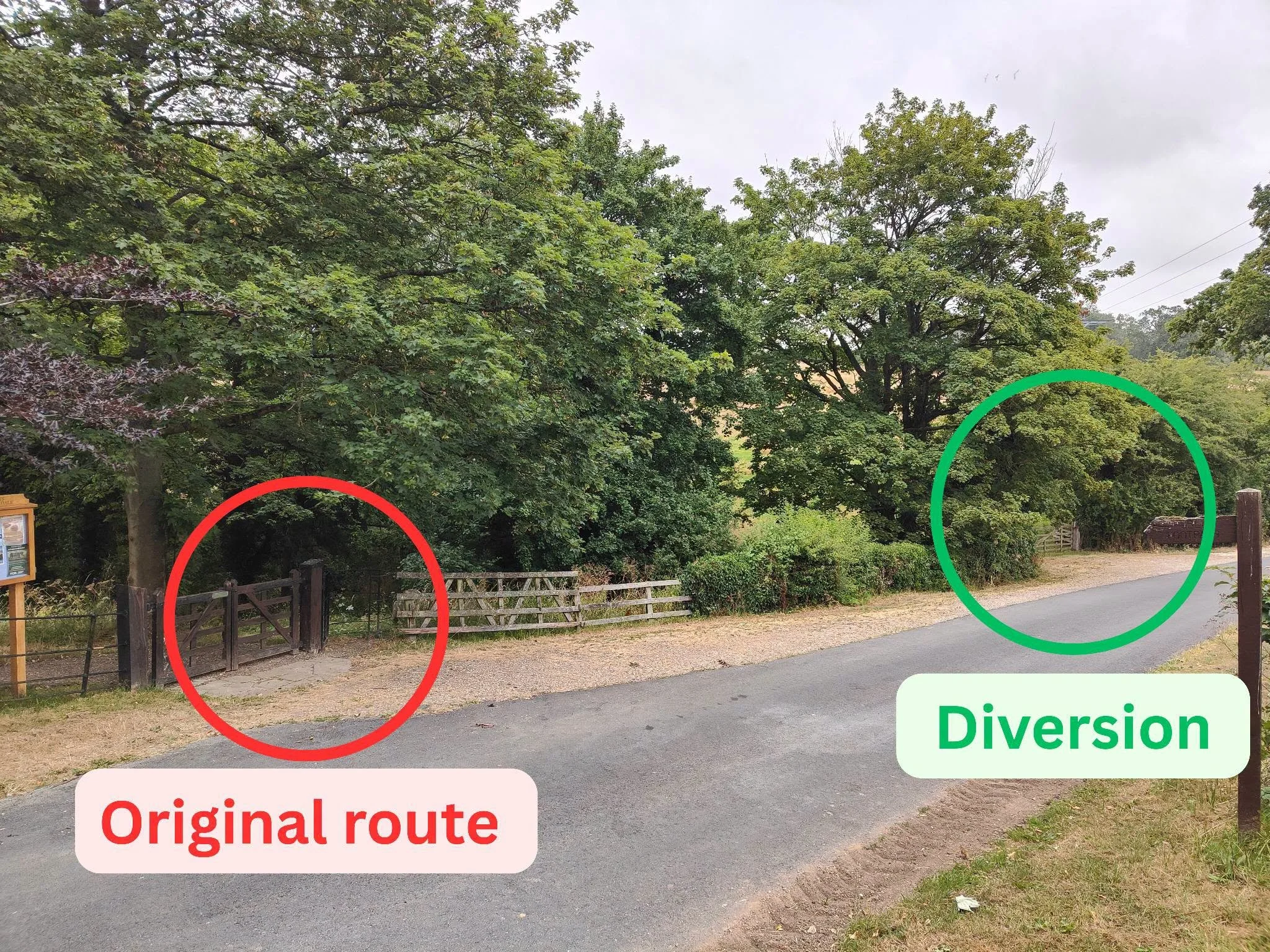
Due to a damaged bridge just outside of Checkpoint 2, there is a small diversion in place on the route. The diversion has been agreed with the famer and takes you directly through the adjacent field, avoiding the bridge crossing altogether.
The diversion is very close to the original route and no GPX update is required. A marshal will be positioned at the diversion point to guide you, and the route will also be clearly marked. Please refer to the image below for details.
Please follow the marshal's instructions and course markings on the day.
Using your tracker


Don’t forget, you are provided with a tracker. Not only can friends and family track your progress, you can also use this as a navigational tool. The tracker link enables you to:
Locate exactly where are you on the route where there is mobile signal.
Discover checkpoint and water station location and details. When you click on a circle icon it will tell you what facilities are available at that checkpoint or water station.